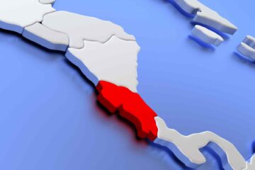
CRAW Region #1, Country #7: Panama
Geographically speaking, Panama is certainly a part of Central America. However, the familiar refrain of the histories of the other countries abruptly ends with Costa Rica. From the indigenous people to the Spaniards, and into the last century, Panama has always been more closely linked to its neighbors to the south.
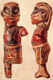
The indigenous people of Panama left no record of great civilizations or empires. Surviving on land consisting of either rugged mountains or swamps; featuring heat, humidity, and a cornucopia of tropical diseases was probably accomplishment enough.
Fortified by the inhospitable land, the indigenous people held off Spanish occupation for a time, but eventually the Spanish (Balboa) discovered the short route to the Pacific and established settlements. However, this was no land for banana or coffee plantations.
The economic mainstay was the road built to connect the Pacific to the Rio Chagres, and then by boat to the Caribbean.
Thru this narrow passage flowed the wealth stolen from the Inca Empire and the rest of western South America.
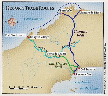
Of course funneling all that wealth thru such a narrow passage was an irresistible temptation for the English privateers, who began a regular plunder of the treasures. The Spanish built forts at either end to protect their passage, which were taken and destroyed by the English. The destruction of Portobello in 1739 was the final nail in the coffin of the trans Panama route, as the Spanish abandoned it in favor of the perilous passage around the tip of South America.
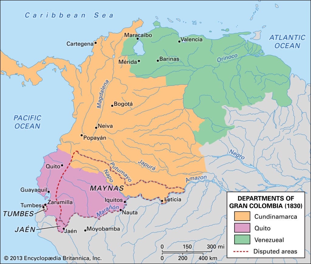
Even under the Spanish, Panama was part of the same administrative unit as Colombia and Venezuela. And when it achieved independence in 1821 it joined Simon Bolivar’s Gran Colombia, consisting of present day Panama, Colombia, Peru, Venezuela, Bolivia, and Ecuador, rather than the Federation of Central American States. Gran Colombia was not a term used contemporaneously, rather it is a term used by historians to distinguish that Republic of Colombia from the current Republic of Colombia.
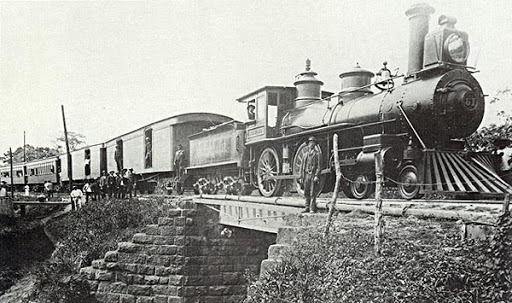
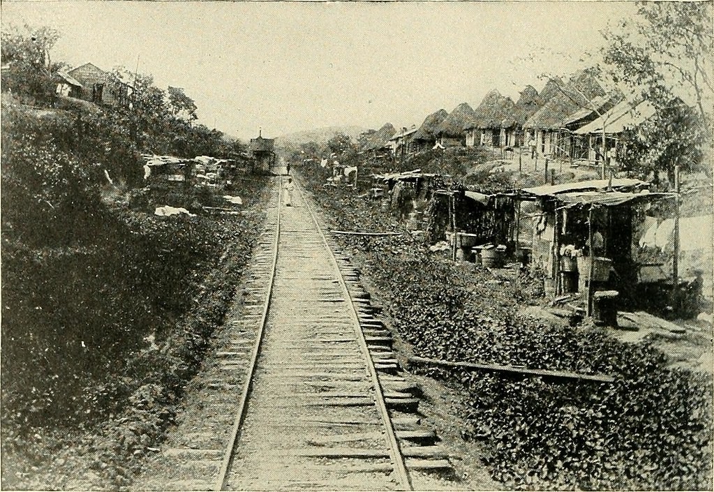
In 1846, Colombia granted the US the right to build a railway across Panama, and the shortcut between the oceans was open for business again. During the Gold Rush, tens of thousands of Americans crossed from the East to the West Coast via Panama to avoid the hostile Indians still on the plains.
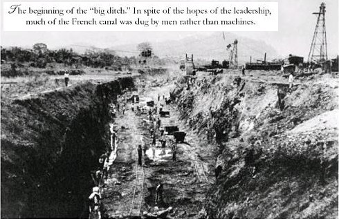
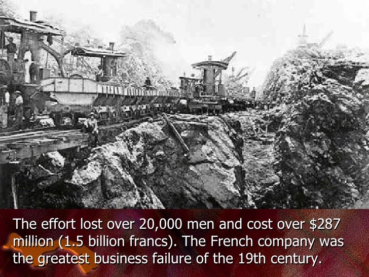
In 1878 the French, fresh off the successful building of the Suez Canal, were awarded a contract to build a canal across Panama. Ten years later, with 22,000 workers dead from yellow fever and malaria, the bankrupt French company gave up the attempt.
The US, which had been scouting a potential canal route in Nicaragua (if you remember, we passed right over it along Lake Cocibolca) saw this as an opportunity and worked out a deal to purchase the French concessions. Colombia refused to allow the sale.
So the US promptly backed a Panamanian declaration of independence from Colombia in 1903. Colombia sent troops to quell the revolution, However, US warships blocked them from landing the troops, sealing the deal on Panamanian “independence”. Colombia did not recognize Panama until 1921, when the US paid Colombia $25 million in compensation.
The first US treaty with Panama gave the US permanent possession of the Canal Zone and the right to intervene militarily in Panamanian civic affairs. Needless to say this was not well received, as the US intervened repeatedly in Panamanian political affairs. In 1936 the US relinquished its “right” to military action outside the Canal Zone and to seize land for “Canal Purposes.”
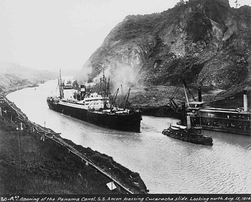
Continuing pressure from within Panama eventually forced the US to cede control of the Canal to Panama, with the US withdrawal completed by the end of 1999.
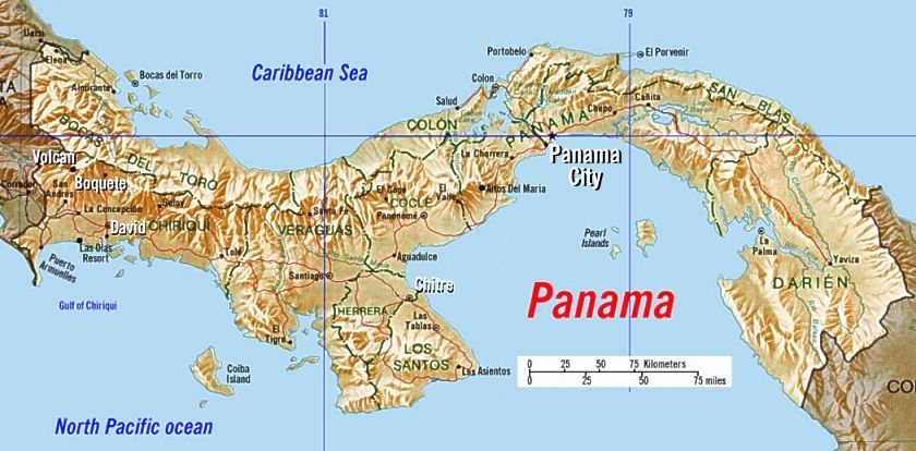
Entering Panama at 3,460 kilometers, we are on the home stretch of Region 1. After the small climb over Paso Canoas, you will drop down onto the Pacific Coastal Plain. To the east you will see the Spine of the Tabascara Mountains accompanying you on your journey. Those same mountains block the Caribbean moisture from the plain, leaving you to pass thru scrubby forest, small farms and numerous small villages on the 70 kilometer trip to the city of David.
Passing thru the center of David you will see the Bolivar Barrios; another reminder that we are now culturally and historically in South America. At 3,550 kilometers you will cross over an inlet of the Bahia de los Muertos, the Bay of the Dead, and then climb over a couple of small mountains that stretch down from the Central Tabascero to the ocean, before dropping back onto the coastal plain.
For the next 200 kilometers you will cross the plains, winding your way thru the cones of ancient volcanoes. Panama has only 4 active volcanoes (maybe 5), most behind you near the Costa Rican border. Finally, the coast will turn sharply up to meet the Tabascero Mountains, and you will get to experience a couple of memorable ascents and descents before you make your final approach to the Panama Canal.
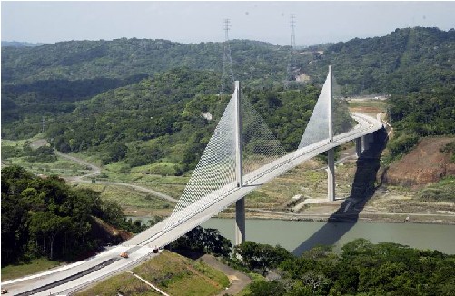
You will cross the Canal on the beautiful Centennial Bridge, a modern suspension bridge between the Miraflores and Pedro Miguel Locks. You can count on seeing some huge oceangoing vessels on their transcontinental journey. Centennial is supported by two 184 meter (604 feet) towers, with the coiled cables trailing down in a single line creating the appearance of two huge sails as you approach.
Once across the Centennial Bridge you will turn north to parallel the Canal towards the Caribbean…. Yes, north. Panama has such a twist in the middle that the Panama Canal actually travels North-South. This is where you find out what panama is all about. Hills. Steep and frequent hills. Your trip across Panama will be the most difficult 60 kilometers of your journey so far.
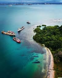
The course could continue further south (Panama bends again right after the Canal), but it would come to an end at the Darien Gap. The Darien Gap has still not been penetrated by any road, and Colombia can only be reached by sea or air…. I am glad it is still that way. There needs to be places like that.
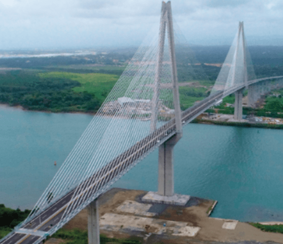
You will come out of the hills into Panama’s second largest city, Colon. After a short side trip to the Enrique Adolfo Jiminez International Airport to pay your exit tax ($40), you will come to a second magnificent suspension bridge, the Puente Atlantico. This is a brand new span, only opened in August of 2019. With twin towers on either side and double sets of suspension cables, and nearly two miles in length, the Puenta Atlantico will be a memorable step in your long trip around the world.
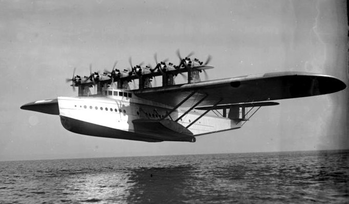
After coming off the bridge it is only another 10 kilometers to Fuerte Sherman, where you will meet our trusty Dornier DO X for the flight to Colombia.
We are counting on those of you who reside or have visited these places
to enrich our file of pictures, information, and stories about the places we are visiting. Anything is fair game: Geology, History, unique places to visit, quirky local customs, you name it. We call this part “Boots on the Ground“. Nobody really knows a place better than someone who has their boots on the ground.
If we all share what we know, we can all have quite a journey around this planet. Don’t be shy. If there is one thing I have learned, it is that everyone I meet knows something that I don’t know. Your perspective will make everyone’s trip more enjoyable.
Please share your stories in the comment section below.
My youngest niece was born in David 25 years ago. I got to experience a small earthquake the night before she was born. Beautiful area with great coffee and amazing rose gardens nearby in Bouquete. Will have to dig through old photos and find one to post.