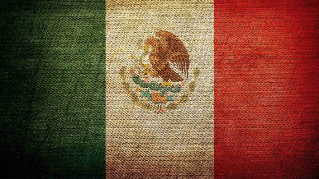
CRAW Region #1, Country #1: Mexico
We start our journey around the planet with Latin America, the scene of a collision of colossal proportions, where three of the earth’s great tectonic plates all come together. The North American plate is moving south, the Pacific plate is scraping across its west coast moving north, and the South American Plate is moving west, scraping the bottom of North America and shoving into the Pacific. All this bumping and grinding has broken off smaller plates along the boundaries of the big three. The Caribbean plate is between North and South America, driving southwest, meeting the Cocos plate which is between the Pacific and North American plates driving northeast. The Caribbean plate is pushing over the top of the Cocos, the collision of the two forcing up the leading edge of the Caribbean plate into the narrow isthmus of land between North and South America that we call Central America. Mostly the incredible forces of this massive collision escape our notice by happening in geological time, with the plate movement measured in inches a year. However, the forces build up over time resulting in sudden slippages that occur in human time. When geological events happen in human time, we call them catastrophes. Earthquakes and volcanic eruptions are geological events that happen in Human time.
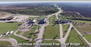
Crossing the Los Indios Free Trade Bridge, south of Los Indios, Texas (which allows pedestrian traffic) we head south on Cantu Road to Mexico 53 and then 101. The population will thin out rapidly as you move away from the US border, and you will find yourself traversing a uniquely difficult place called the Mexico Gulf Coastal Plain. Mexico proper is defined by three Mountain Ranges. The Sierra Madre Occidental is just to your west, pushed up over the last 23 million years by the collision of North American and South American plates, with the Caribbean plate an unhappy intermediary. Along the Pacific Coast, a second range, the Sierra Madre Oriental similarly has been pushed up over the past 66 million years by the collision of the North American and Pacific plates. At the southern end, the two are connected by the Sierra Madre Del Sur.
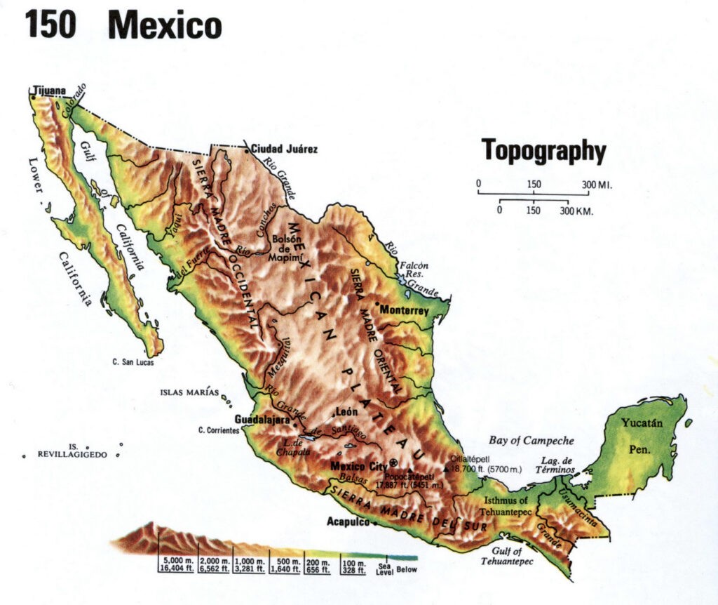
Between them, most of Mexico’s land has been pushed up into a high plateau. We are on a band of flat, low lying land between the Sierra Madre and the Gulf of Mexico.
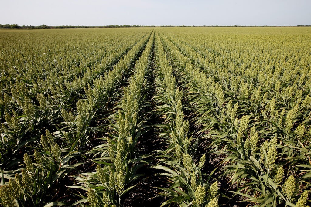
Unlike the countries further north, the temperature gradients in Mexico are determined by altitude, not latitude, and are relatively stable all year long. The higher in the mountains you go, the cooler the temperatures are. Unfortunately for you, you are traveling at very low elevation along the coastal plain. In addition, there is the constant high humidity due to the proximity to the Gulf. You will be hot. Really HOT! You are passing thru the Mexican state of Tamaulipas, a fertile land with an excellent agricultural climate. You will pass thru endless fields of sorghum, cotton, corn, and wheat, as well as livestock farms raising cattle, pigs, goats, and sheep.
Small villages scattered along the way would make this a scenic and peaceful section of the trip if it weren’t for the prevalence of gang warfare, running gun battles, robberies, and kidnappings. As you proceed further south, the farmlands are broken by patches of thorny scrub forest.
The history of this Northern half of Tamaulipas presages the lawlessness of today. Nomadic tribes inhabited the area some 8,000 years ago, with permanent settlements dating back about 6,000 years. Further south in Tamaulapinas the Olmec later Huastec civilizations dominated. But the land we are passing thru was the domain of people loosely called the Chichimec. In essence the term Chichimec was a pejorative with a meaning roughly the same as “barbarians”. In the mid 1400’s the Aztec conquered the Huastec, turning them into a tribute paying vassal state. They did not, however, totally pacify the Chichimec lands, as some indigenous tribes (notably the Comanche and Apache who were later to turn up in the US west) were never subjugated.
During the early 1500’s there was a great upheaval to the south, as the Spanish formed a coalition of former Aztec vassal states to overthrow the Aztecs. Spanish silver mining interests in the mountains to the west and settlers in the Gulf Coastal Plains decimated or drove out the Chichimec.
Later, when the French settled New Orleans and Louisiana, the Spanish tried to encourage settlement in Tamaulipas and what is now Texas, with limited success, as the Spanish were more drawn to the Mineral riches in the mountains. Ultimately the part of the country north of the Rio Grande was settled by settlers from the US, with Texas first revolting to gain independence and later joining with the US. A loss whose proportions depend, I suppose, on your opinion of Texas. In the early 1800’s Mexico itself would revolt against Spain and gain its independence.
After a 440 kilometer trek, with the Sierra Madre closing in from the west and shrinking the Gulf Coastal Plain to a narrow swath we will come to the coast of the Gulf just north of the first major city on our trip; Tampico , Mexico.
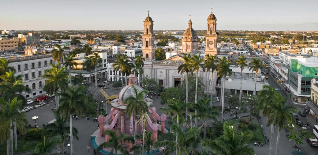
From Tampico we will travel another 510 kilometers along the coast to reach Veracruz, in the state of Veracruz.
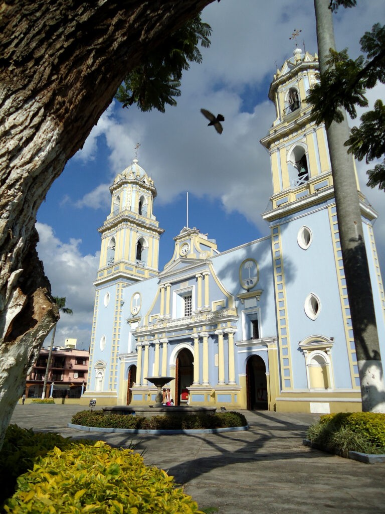
Veracruz lies on the Mexican Volcanic Belt, created by the heated magma from the leading edge of the Cocos Tectonic Plate slipping underneath the North American Plate.
The history of Veracruz is as volatile as its geological foundation. Crossing the state of Veracruz, on our way to the Isthmus of Mexico, we will pass thru the locations of the ancient civilizations of the Huasticos, Otomies, Totonacas, and finally the Olmecs, one of the oldest civilizations in all of the Americas. All of them except the Olmecs (who had been replaced by the Maya in the southern part of Veracruz for about 1800 years) were of course subjects of the Aztec Empire when the Spanish arrived. If you have always imagined that Spain found Mexico populated by Aztecs, and by some miracle 18 Spaniards defeated an entire population of millions, your journey is probably dispelling that misconception. The Spanish found a continent of thriving civilizations with thousands of years of history, and a political stew every bit as complex as that in Europe. What they did not have was any resistance to smallpox and firearms. The firearms were probably the less lethal of the two weapons.
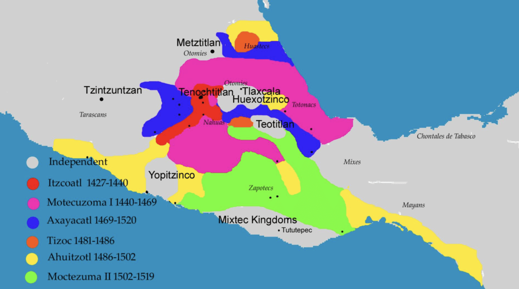
Spanish leaders defeated the Aztecs because they were able to form alliances with subjugated populations who had their own political interests at heart. Ultimately they found that they had made a deal with a worse devil than the Aztecs.
Veracruz (meaning “True Cross”) was founded by Hernando Cortez, the conqueror of the Aztecs and the state of Veracruz is the richest of the Mexican states, with many resources, including 35% of Mexico’s fresh water, mineral wealth, four deep water ports and two international airports.
Turning west from Veracruz we will start across the Isthmus of Tehuantepec.
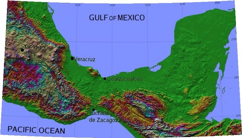
The Sierra Madre Del Sur which connects the two Sierra Madre ranges along the East and West coasts of Mexico is now to our north, and the Sierra Madre De Chiappas, which is the spine of northern Central America is to our south. The isthmus of Mexico is a relatively flat corridor about 250 kilometers from the Gulf of Mexico to the Pacific. Prior to the building of the Panama Canal it was the primary land route for cargo to move from the Atlantic to the Pacific without the perilous voyage around the tip of South America. While wider than Panama it had the advantage of not having dense jungles! Even today there are dreams of building a rail connection by which ships could be transported overland to compete with the Panama Canal.
Between 1380 and 1400 kilometers into our journey we will cross the tip of the state of Tabasco.
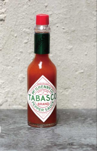
What is Tabasco known for? Not hot sauce! Tabasco Sauce is made on Avery island in Louisiana, and although it got its name because the Tabasco Pepper is supposedly from Tabasco, but Tabasco Sauce is nowhere to be found in Mexico. Tabasco is actually known for being the first place in Mexico we will encounter rainforests and as the center of the Olmec culture, which is considered to be the first Meso-American civilization. The other big event in crossing Tabasco into the state of Chiappas is that we will cross from the North American Plate onto the Caribbean Plate. You have truly gone somewhere when you cross continental plates.
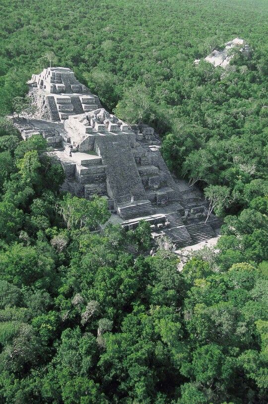
From Tabasco into Chiappas we will slip to the south of the Isthmus and into rain forest and mountainous country on our way to the Pacific coast. In Chiappas we are finally in Mayan country, with a number of the ruins we associate with the famous culture.
However, the first civilization in Chiappas was the Mokaya who are thought to have been the forefathers of the Olmec, migrating across the Sierra Madre De Chappas to the Gulf Coast. Chiappas was never Olmec territory, but maintained close relations with them.
The arrival of the Spanish was muted by the inaccessibility of Chiappas, and the lack of mineral wealth. It was the last area to be completely subdued and still has the largest population of indigenous people in Mexico. It remains the most isolated part of Mexico, with extreme poverty and minimal government control.
We will arrive at the Pacific Coast in Arriaga at 1580 kilometers. And travel between the mountains and the ocean for the next 250 kilometers to reach the last city on our journey thru Mexico, Tapachula, near the Guatamalan
border.
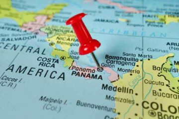
At 1855 kilometers we come to Ciudad Hidalgo on the Suchiate River and prepare to cross into Guatamala.
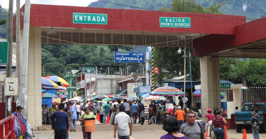
In order to cross the border into Guatamala: First you must visit the Mexico Migration Office and get your exit stamp. You will have to pay the Departure Tax., and get your visa stamped for your departure. Once you have your departure Stamp you are allowed to cross the bridge into Ciudad Tecun Uman. Once in Ciudad Tecun Uman you are supposed to proceed directly to the Guatemala Migration Office. It is not right on the border, but it is highly recommended that you adhere to the rules and stop there for your entry stamp. You are not supposed to pay entry fees to enter Guatemala, but probably a fee will be requested. If you want to throw your weight around you can ask for a receipt and they will probably drop the fee. This is the second worst idea to skipping by the Migration Office altogether.
Now it is time to enjoy your run or ride thru Guatemala.
The travel guide we have is just a starting point.
We are counting on those of you who reside or have visited these places
to enrich our file of pictures, information, and stories about the places we are visiting. Anything is fair game: Geology, History, unique places to visit, quirky local customs, you name it. We call this part “Boots on the Ground“. Nobody really knows a place better than someone who has their boots on the ground.
If we all share what we know, we can all have quite a journey around this planet. Don’t be shy. If there is one thing I have learned, it is that everyone I meet knows something that I don’t know. Your perspective will make everyone’s trip more enjoyable.
Please share your stories in the comment section below.
I run in the mountains around Mexico City, sleeping at 7,500ft and training between 9,500-12,000ft. This is a photo of the 3 volcanoes that can be seen at the “Mirador” a run between Mexico City and Toluca.
Volcanoes “El Mirador”